CORAL REEF STUDY MAPS
REEF FISH
MAPS
REEF FISH DENSITY
Scroll through the maps showing fish density. Click on each map for an expanded view.
REEF FISH BIOMASS
Scroll through the maps showing fish biomass. Click on each map for an expanded view.
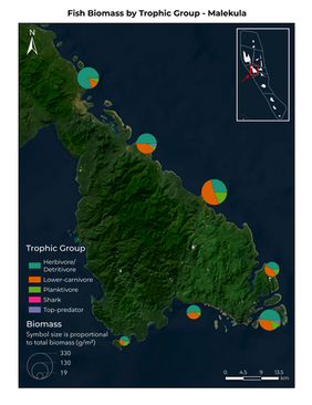
TOTAL FISH BIOMASS BY TROPHIC GROUP
Scroll through the maps showing fish biomass by trophic group across islands. Click on each map for an expanded view.
FISH OVER 50CM + 100 CM
Scroll through maps showing observations of fish over 50cm and 100cm. Click on each map for an expanded view.
BENTHIC COVER
MAPS
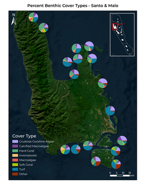
PERCENT COVER BY COVER TYPE
Scroll through the maps showing percent of benthic cover by cover type. Click on each map for an expanded view.
PERCENT BENTHIC COVER ACROSS ISLANDS
Scroll through the maps showing percent of benthic cover types across islands. Click on each map for an expanded view.
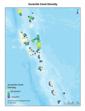
CORAL RECRUITMENT
See the map below for juvenile coral density. Click for an expanded view.
INVERTEBRATE
MAPS
INVERTEBRATE DENSITY
Scroll through the maps showing invertebrate density. Click on each map for an expanded view.


